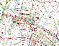
Honoka'a & 'Ahualoa
Notes on using the VTP software to create a 3D model of the small town of Honoka‘a
and neighboring area of Ahualoa.
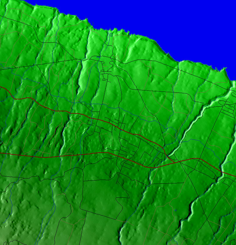
Small Elevation Area - Honoka'a3
- extracted directly from 10m DEM, NAD83 at (238600.0, 2219400.0), (
6000.0, 6000.0)
- at a 2k grid, this is 2.93m spacing (honoka'a3_2k.bt)
- the roads are imported from DLG, and adjusted to align with the NAD83
elevation (honoka`a3.rmf)
- roads are used to deform elevation with 2m margin and fade-off zones,
resulting in (honoka'a3_flat_2k.bt)
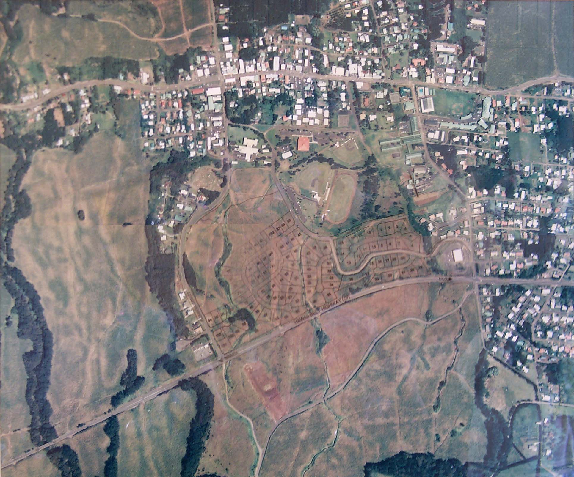
- attempted to georeference an aerial (#1, below) resulting in:
- coverage of area (241245.0, 2220960.4), ( 1601.6, 1474.9)
- at 1639 x 1514 pixels, that's spacing of 0.97718, 0.97417; made
corresponding world file
Original Extraction
- starting with big island elevation
and vector data
- loaded the USGS 10m DEM, extracted an area at (239176.4, 2218879.3), ( 6196.2, 6447.7)
- by loading the hydro DLG and comparing the shoreline, there is a big
visible offset between the DLG and DEM data
- measured the offset with the Distance tool:
- used "Layer - Offset Coordinates" to move the road and water layers to
line up with the DEM
snapshot of elevation, road and water data in VTBuilder
DRG and extracted buildings in BExtractor
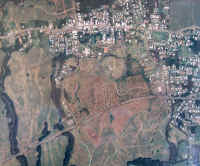
aerial 1, from a poor photo
of a wall print |
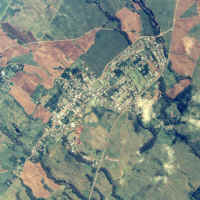
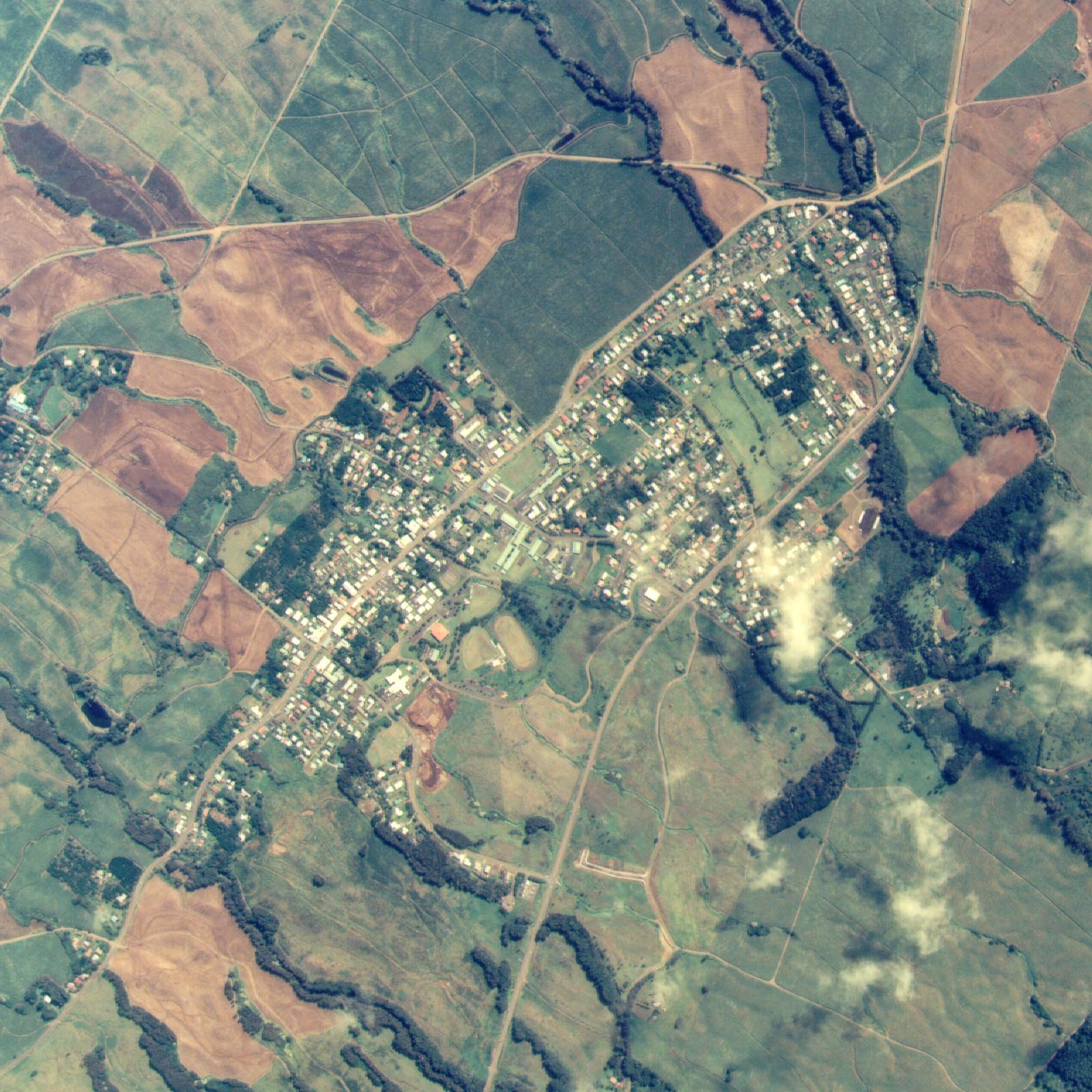
aerial 2, flatbed scan of a
print from Air Survey Hawai`i |
- had some trouble aligning the buildings to the other data
Honokaa Resources
Ahualoa Imagery/Roads
- Like the rest of the wet parts of the island, it is a difficult place to
get imagery data for. Even Google had substantial cloud cover until
2010, and as of 2011, there's still no aerial, just poor-quality space
imagery.
- Most of Ahualoa is in the Honokaa USGS quad, but the western part is in
the Kukuihaele quad.
- Road data source:
- USGS 7.5" DLG (honokaa and kukuihaele, presumably in NAD83)
- Quality isn't that bad. There are some spurious driveways,
but it follows the actual main highway pretty well.
- There is only one notable spurious road: a straight connector
from west Puaono uphill to the highway. It's very surprising,
because it doesn't appear in the DRG topo map which is the source of
this DLG.
- There are also cane roads, which once existed but are gone
today.
- Mostly, it suffers from lack of completeness and timeliness.
- Tiger 2010 - roads available as Shapefile (tl_2010_15001_roads.zip
for whole island)
- Quality is very bad. It only agrees with reality on the
main road. All side roads are bogus, and there are hundreds of
spurious driveways.
- OpenStreetMap, which as of January 2011 was identical to Tiger 2010.
- Closed road data, for comparison:
- Google (map and earth).
- Does not match any of the public datasets, but it is not
better quality either. It has Puaono Rd. going all the way
through.
- There is a major collision between streetview of Ahualoa
(apparently every road) being "snapped" to the terrible roadmap, so
that many roads are missing from streetview, just because the
roadmap didn't contain them.
- Microsoft (bing)
- Does not match any of the public datasets. It is probably
the most accurate, as of January 2011. Like the DLG, it matches the
curves of the tax map fairly well. Like Google, it has Puaono
Rd., but it also has Kapena (called "Homestead") going all the way
up to meet the west end of Puaono.
- Interestingly, there are excellent oblique aerials covering a
few parts of lower Ahualoa, and apparently all of Honokaa!
Unfortunately, the Bing interface doesn't indicate where the oblique
coverage exists, so it it s tedious process of panning around to
find the area.
- February 2011, i personally corrected all the OpenStreetMap roads in
Ahualoa (and most of Honokaa and surrounding towns). So, now OSM is
far more correct/complete than any other source. December 2013, I did
another round of major improvements to Honokaa OSM including many of the
building footprints.