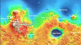
- Mars Orbiter
Laser Altimeter (MOLA)
- includes a gridded topographic map (EGDR) at up to 1/128 degree resolution
- these are in a raw format (.img) an a cylindrical projection, with a header describing extents
- The Celestia Motherlode: Mars Surface Maps
- J Hasting's Mars page
- GeoFusion Mars Demo
- standalone downloadable demo for Windows, 32MB
- Paul Bourke's Mars, renderings from the 1/32 degree dataset
- NASA World Wind can be configured to show Mars, both imagery and elevation
- Druantia is an open-source
project (GPL) to produce a Mars visualization
- still in the early stages as of January 2005


