Greece
< back up to Europe
- reported December 2006: "A big discussion is made upon Greece's interaction
with the, recently approved by the EU,
INSPIRE directive. Greece
does not have a National SDI yet. The main public agencies that produce,
manage and provide geographic data in Greece:
- The
Hellenic Military Geographical Service
is licensing core data: aerial photographs, digital elevation models, cartographic
and topographic maps, elevation points, etc). They plan to develop soon
a Geoportal that will serve product viewing and ordering online.
- The Hellenic Mapping & Cadastral Organisation (www.okxe.gr)
is responsible for the Greek cadastral. Also provides geodetic data, air
photos, orthophotos, Corine land cover data, dem, road and rail data, administrative
boundaries, etc. Only CORINE Land Cover data is free. All the rest is licensed.
They also plan to develop a Geoportal that will serve product viewing.
- The Hellenic Ministry for Environment and Public Works
(www.minenv.gr) is responsible for providing
environmental data (e.g. protected areas, vegetation, flora, fauna, air
pollution etc). The national network for environmental information
(EDPP) is part of the
European Environment Information and Observation Network EIONET. The
Ministry plans to develop the EDPP as an SDI that will enable data viewing,
in line with the INSPIRE standards."
- At the listed price of €3.57 per square kilometer, it would take €471086
just to license the 30m DEMs for the country!
- As of 2010, the site
www.geodata.gov.gr claims to have "public, open data"
- It is primarily vector data; city zoning, land cover, pipelines...
- It also links to WMS access to "Orthophotos for the whole of Greece"
(!) from
Ktimatologio S.A.
- The Greek coordinate reference system, namely EGSA 87 by its greek initials,
is a Transverse Mercator projection which covers the whole country.li>
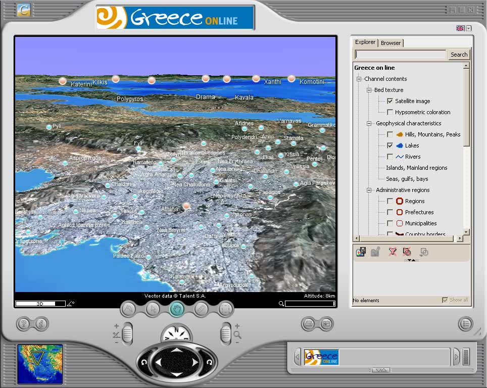
- The Greek company Talent had a demonstration
for their 'Cruiser' platform called
Greece on-line (offline as of 2007?) which provides
a simple fly-through of Greece, using primarily public-domain elevation and
imagery with a few high-level feature sets. Detail is no better than blurry
LandSat.
- In 2004, Photon Research Associates,
Skyline Software,
i-cubed and
LeadDog created a
web-based interactive 3D 'fly-through'
of Athens Greece. It was still online as of 2006. (Gone as of
2011)
- The image quality is reasonable, using a decent aerial instead of LandSat.
- The interactivity is strictly navigation. No structures, just
a few vectors and labels.