Parts of the world will become virtualized as time and people arise to tackle
them. If you are working on any particular location and are willing to
be listed here, please let us know!
3DCarto distributes
"for all Italian territory, Orthophoto, Aerials and DTM" ready for use in their
software
Il Lupo sells 2D/3D map software which
appears to do some realtime terrain rendering
a contact: Charles Macmillan (charlesmacmillan@hotmail.com),
looking at large datasets of northern Italy and of Austria, combining DEMs with
satellite imagery
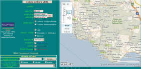
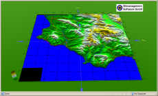
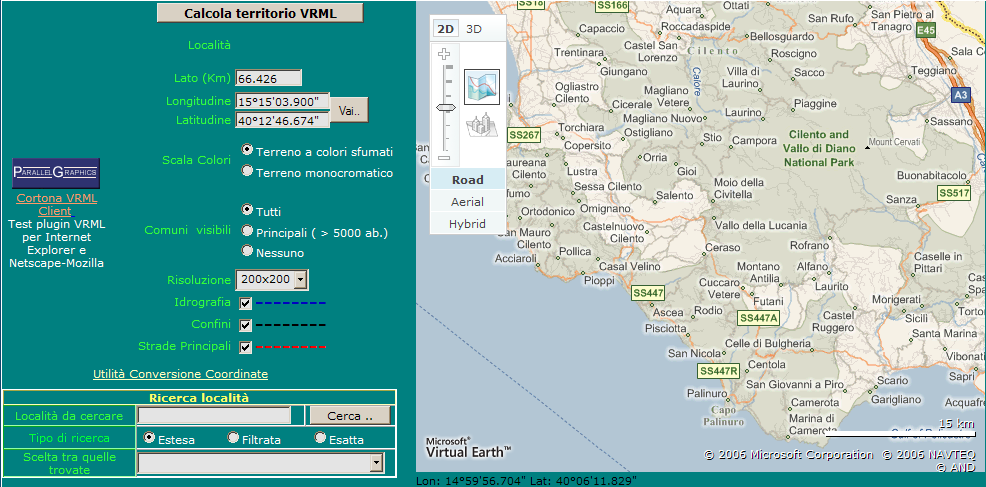
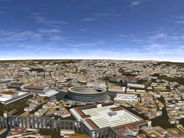
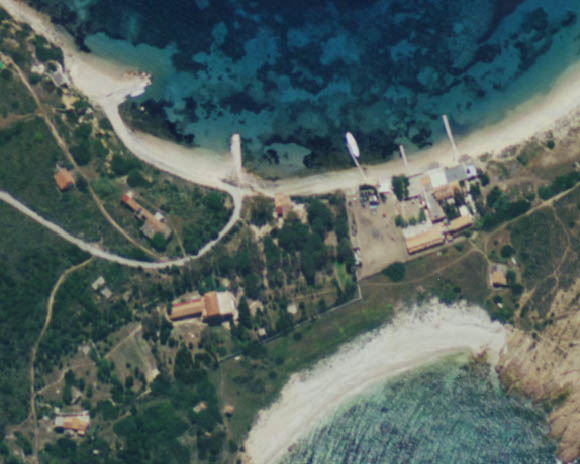
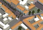
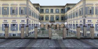
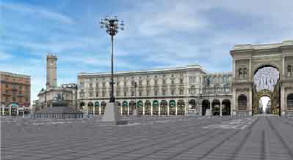
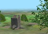
A nifty web utility (in Italian) for browsing to any part of Italy in
a 2D map browser, then converting that area of the terrain to a VRML output
file. I found it easy to use, although of course suffering from the
drawbacks of VRML (file size, syntax errors reported, difficult navigation,
etc.)
Places
The Ultramundum project has modelled
some places in Italy
However, all the projects say "The Foundation can
arrange interactive demonstrations on request, because this product can
not be freely distributed yet."
A very early alpha version of their software is available from their
download page.
Apparently these are part of a much larger, more ambitious project called
4DGea,
which says "Any place on Earth will be explorable and it will be possible
to visit it not only in three dimensions but in any period of the past...
4DGea will became the greatest work ever done by mankind, a four-dimensional
book whose pages will contain everything we know of our history, everything
of our science, everything of our culture, everything about our endless
adventure."
An ongoing project (1997-2007) by teams at the University of
Virginia, UCLA and Politecnico di Milano, to create a 3D model of the
ancient city of Rome. The notional date of the model is 320 AD.
The primary purpose of the model is to present information and theories
about how the city looked at that moment in time, roughly the peak of
its development as the capital of the Roman Empire.
A free Windows application which gives a flyover of the island of Sardinia,
similar to a simplified Google Earth.
Actually, compared to GE, the elevation is more accurate, but the imagery
worse, the paging is slower, and there are no cities or other culture.
Here are side-by-side images showing the same place (on the island of
Tavolara) in Sardegna3D vs. GE:
I don't read Italian so i'm not certain what the purpose of this software
is; it doesn't seem to have any culture or to be open for any use besides
flyover.
The city of Magnago (in Milano Province) was modelled by
tecnolution as "Magnago
Virtuale", an experiment of urban simulation on a small/medium scale, created
in conjunction with the city center renovation project. Interestingly,
they provide several different ways to view the model:
VRML, built on the Cortona VRML Client
panning over a large pre-rendered 3D view, using Flash
panning around in pre-rendered panoramic views, using Flash
rendered video of walking around the model, using Flash
Website with an embedded interactive flyover of all of Italy
Uses nicely cleaned-up public data for elevation, imagery, and point
locations for cities
Andrea Caporin explains: "The DEM data are SRTM data, interpolated to
cover the voids and resampled to about 250m to improve the visualization
speed. The textures are obtained by LandSat ETM+ scenes (PAN+TM),
with final resolution of 15 m. I worked very much with Global Mapper
and then with Photoshop."
Built on the Blaxxun VRML control which unfortunately means that it
is Windows and IE only, and must do paging in a very blocky, chunky fashion
(huge pops)
Navigation is smooth and easy, although very constrained (fixed elevation,
no pitch) which is appropriate for novice visitors