State of Washington
< back up to USA
Elevation
- DEM
- 10m DEMs are available. the UW site has
Washington
10-meter DEMs
- would a 1k*1k (10km*10km) area be big enough to fit the city of Seattle?
not really, 2k*2k is better.
- NED
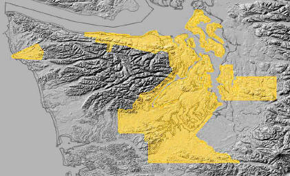
- amazingly, there is 1/9 arc-second elevation available on the
Seamless National Map server, just
for the Puget Sound area - see coverage area to the right
- it is so detailed that you can see the individual flat road surfaces
- all water areas are marked as "no data", including the sound and Lake
Washington
- the UW Geomorphology Research
Group has been attempting to assemble an integrated dataset for Puget Sound
that has both normal elevation and bathymetry
- this is a very tricky task, and they've been trying for years
- Puget Sound
LIDAR Consortium is the site of the current group:
- "public-domain high-resolution topography for western Washington"
- unfortunately, the elevation data is in the inefficient and awkward
.E00 format
- interesting issue: the large body of water east of Seattle is indicated
by the DEMs as 4 meters above sea level - how should software know to treat
it as a water surface? Could exploit the DLG hydro areas.
Imagery and other data
Seattle Area
- existing product: Virtual Seattle (now defunct - see
Virtual Tourism)
- central Seattle is interesting terrain - very hilly, with lots of water
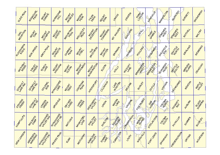
- six 7.5-minute USGS Quads cover most of the area of Seattle:
- duwamish head, kirkland, mercer island, seattle north, seattle south,
shilshole bay
Town of Cheney
- contact Ron Hall <email>
has done some VTP modelling of Cheney, location of
Eastern Washington University
- in 2005, assembled some basic scenes using USGS Images
(1996) and DEMs, added some buildings with VTP building tool
- the city was shown the visualization and responded positively,
assisting with providing better data, including higher resolution imagery
from Avista (power company) and interpolated elevation data (done by Avista
from DEM) for the City limits including the main campus of EWU.
- 3D studio max to model a few buildings
- in 2006, putting together a new visualization with the
newer, better data
- 2006-05-04: 3D students just finished the "rough" draft
of the campus project - an animated tour of a good portion of the campus
in 3D StudioMax
- 2006-05-27: Have "unedited" copies of about 20 of the
major buildings on campus
 University of Washington
Data Site has a great deal of data, especially their
Raster Data
University of Washington
Data Site has a great deal of data, especially their
Raster Data