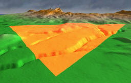
A common need is to display conventional 2D GIS features (points, lines,
polygons) on a 3D terrain. The process of projecting a 2D feature on a
3D surface is known as "draping". For very simple features, or a very
flat terrain, this is almost trivial, but for complex features on uneven
terrain, it is difficult to draw the features perfectly.
The most common solution to these problems is to raise the feature
geometry by some offset, such as a few meters. This is usually
visually acceptable if the viewpoint will remain must higher above the
terrain than the offset. If the camera is very low, the offset must be
small so that the feature does not appear to "float" above the terrain.
If the camera is very high, the offset must be large for Z-buffer precision.
Some software (such as Google Earth) deals with this by using a dynamic
offset, raising the feature geometry as the viewpoint elevation increases.
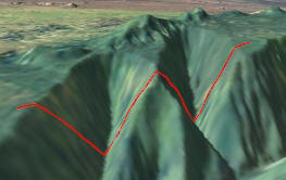
 The
simplest approach is to convert each 2D point on the polyline to a 3D point
using the height of the terrain, then draw the resulting 3D polyline as a
series of line segments. That is only sufficient if the terrain is flat, or
the input polyline has vertices at each inflection point of the terrain.
