Virtual Tourism
Websites
- Switzerland - for some reason, there are numerous 3D projects there
- Flying
Over Switzerland (Viewtec) -
apparently discontinued around 2006
- Lucerne / Switzerland in 3-D
- tourism-oriented website with a few city walkthroughs
- uses the Java-based Shout3D engine as a plugin
- the 3D parts didn't work for me when i tried it on 04.08.28, after
"loading models" and "parsing scene", only a empty black window
- DORIS - interMAP
- Austrian digital space imagery organization offering a
3D visualization
of the Traunsee region of Austria (again, using the Geonova / G-Vista
software)
-
In volo sull'Isola d'Elba (fly over the island of Elba, Italy)
- has nice high-res pan-sharpened orthophotos
- uses the 3DIMap
viewer (Shockwave-based web viewer)
Standalone Applications
- Vizerra
- Vizerra produces detailed 3D models of touristic areas - Taj Mahal,
Machu Picchu, Angkor Wat etc.
- The models are viewed with a free, Windows-only application, built
on the Gamebryo game engine.
- It is a somewhat heavy download (50MB, plus ~200MB per scene)
- The company is based in Russia, launched 2008, apparently owned or
in partnership with NVidia.
- While indeed detailed and impressive, the models do exhibit some odd
aesthetic choices, e.g. the hills and terraces of Machu Picchu look like
vivid green styrofoam.
Installations
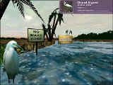
- Virtual Florida Everglades
(1998)
- an educational simulation of the Everglades, with vegetation and
animals
- built on the Unreal game engine by Victor
J. DeLeon, H. Robert Berry
- the goal: "a richly detailed 3D virtual environment, which could be
used to educate the public and promote ecological awareness"
- designed for a location-based installation with a large screen and
multiple viewers
- Virtual Garden Walkthrough
-
 allows
you to take a virtual walk through Japan's famous Motsuji Temple
Paradise garden which was destroyed 770 years ago
- bundled with a jogging exercise machine, so that you get a workout
while navigating around the garden!
 UST Projects
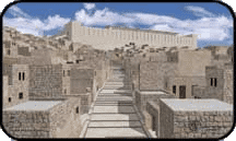
- Jerusalem's Temple Mount
- modelled in MultiGen and running only on high-end SGI machines, the
Urban Simulation Team at UCLA recreated how excavators believe the Temple
Mount site appeared prior to its destruction by Roman troops in the year 70
CE
- opened to the public in 2001, apparently still open as of 2007
Services
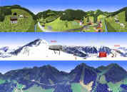 Austrian company 3D BASE
produces animated walkthrough visualizations of tourism development projects
- the 'product' is called TourisVis, "a visualisation system for
tourist regions, which are engaged to provide something special for
their guests"
Academic Papers
CDROM Titles
-
Eingana
- Review (2002):
- was
 around
$60 from PlanetObserver (France)
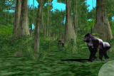
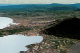
- a remarkable, seamless interactive navigation over the entire Earth, from
space down to ground level, at any time of day
- elevation is 200m over the USA and Europe, 1 km elsewhere
- all of the high-resolution detail around the viewpoint (both elevation and
imagery) is provided by fractal-type random generation, which is
occasionally quite effective and dramatic
- there are a lot of special details, distributed both procedurally and
manually: land and sea animals, vegetation, buildings in a few cities, place
names, satellite image insets, more
- there are some truly unique and stunning effects, such as glowing city
lights at night
- framerate is high when you stand in one place and look around, or move up
and down; zooms in or out from space to ground are exhilarating
- unfortunately, framerate drops to painfully slow (< 1 fps even on a fast
machine) when the viewpoint moves horizontally
- Explore Kilauea
Volcano
- Virtual Holy Land (1999)
- CDROM-based interactive 3D viewer with large, hand-modeled content, of
several real places mentioned in the Bible, from developer "Virtual
Excursions". Impressive for its time. No information on what
became of the title or its models.
Older / Historical
-
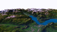
3D Flight Over Switzerland (2005)
- from Geonova AG, using the G-Graphix
tools and G-Vista runtime plugin (now apparently gone)
- absolute beautiful 25m satellite with 1m/0.5m aerial inset imagery
- great data, good interaction speed and reasonable texture paging
performance - an exciting combination
-
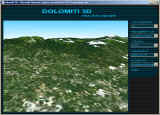
LiveDolomiti
- 3D Flight over Dolomites
- the Dolomites are mountains, situated in north-east Italy to the south
of the Alps
- the website had a number of pre-rendered panoramic images, and a
VRML-based flyover with satellite image and paging
- apparently it evolved into or otherwise merged with
Italy eXplorer
- 'Virtual Seattle' and 'Virtual San Francisco'
- $20 each from Cityscreens Software, a small team in Seattle
[defunct as of 2004]
- they created 3D models of small parts of the cities, and used a
"cartoon map" style for most of the screens, with only 2D interaction
and a couple rendered movies
 Virtual
Messiah (no longer online?)
- was $30 from Virtual Excursions
- included a fly-in from space to Israel (non-realtime) and a walk
around the buildings of ancient Jerusalem (realtime, actually branched
pre-rendered QuickTime segments)
- made with 3D Studio and WorldBuilder
- Axion 3D World Atlas
- was a nice-looking program, with "3D displays of any place in the
world, real-time fly-bys over any portion of the Earth"
- apparently discontinued
- 3dvillage.com (no longer online?)
- "enables visitors to Walk the World by providing an active 3D
environment that is engaging, entertaining and informative"
- used the NxView plugin (no longer online?)
- Athens from Space: a 3D Guide for Tourists (no longer online?)
- "don't be to surprised when you find yourself using Athens from space
just because you enjoy it."
- planned to use VRML (requiring IE5 and Blaxxun Contact)
- Virtual Stonehenge
- realtime 3D, using the Superscape viewer, but a very crude model
- quote: "the public is no longer permitted to walk among the stones, so
the virtual model is now the only way to experience the space"
- many QuickTimeVR sites, such as
Pleasant's
Virtual Hawaiian Holiday
- could be considered virtual tourism, but are really minimal
- has hype phrases like "Visit great places without leaving your room"


 UST Projects
- Jerusalem's Temple Mount
 Austrian company 3D BASE
produces animated walkthrough visualizations of tourism development projects
 Patrick
Aschwanden, Thomas Ohler, Renato Pajarola, Peter Stucki, Kornel Szabo, Peter
Widmayer.
A Virtual Reality based System Environment for Intuitive Walk-Throughs and
Exploration of Large-Scale Tourist Information. Proc. of the Enter95
Conference, pp. 10-15, 1995

 around
$60 from PlanetObserver (France)
 Virtual
Messiah (no longer online?)