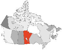
Comments > Manitoba
While I agree that digital spatial data should be considered as a critical infrastructure and provided freely to the user community there is another issue that needs to be addressed. The fact is that most of the spatial data that is now available in digital form requires significant restructuring for most GIS applications. Most of these data were created as part of provincial or federal mapping programs and most of these programs have either been eliminated or shrunk to the point of being in effective. With no new money coming in to the system to maintain what is there, these data will become even more useless over time.From Kenton Friesen, of Mobray Business Solutions in Winnipeg, Manitoba:Everyone uses the USA model for free data as the one to emulate. While there are various examples of how things worked better because of the free access to data I also suggest that a huge part of the success was due to the market differences between our two countries. American firms are generally more willing to take risk because they have a high volume market to serve. They have also developed huge geomatics companies that are relatively unknown and exist solely to support the intelligence and/or defence commuity. Some of this is now spinning out to the civilian community and is having ahuge imapct on the way things are evloving. Their data is not exactly free either, I recently priced DOI data for a medium sized state and by the time I was done calculating all of the handling charges it still cost over $30K in real dollars. Still a long way from being free.
By looking at just the delivery part of the system we fall into the same trap as the cost recovery policy makers. It looks great from one perspective but is a disaster from most others. We need to impress the politicians with the fact that they are missing value in the economy by not supporting data programs and by not supporting the take up of software applications that use these data. This is more than simply buying a GIS package and doing some analysis. We have proven time and time agian that effectively using spatial data enhances the ability of any organization to do their business. If government department managers realized this they would move from a problem (why are we spending all of this money on maps?) to a solution (Improve the way we deliver our programs and services by incorporating spatial data and geographic concepts in our daily work flow.
Unfortunately spatial data costs money to create and maintain. Manitoba has been effective in leveraging private sector investment into the data creation process. Because they also took an applications focus and a partenrship approach with industry, at the same time a strong comapny exists that is doing business in many geographic areas other than Manitoba. So it is not just about access to data. It is about building spatially enabled solutions that provide real value to their users. If we can do that the data cost issue will go away.
The cost of data in Canada has limited the Geomatics community from growing into an industry! The US is racing by us and we will eventually lose both money and people if something is not done soon to curb the cost of data.
From Rick Bowering, of Manitoba Water Resources:
I strongly believe that any data collected at taxpayers' expense should be freely provided to the taxpayer, whether he is with a public institution, another governmental agency, or a consultant making money. I believe the demarcation between free and charge should be the data/information interface. The data has been collected. It should be put on the internet for all to access and use as they like. There is still lots of opportunity to charge for value added products based on that data. This would include any kind of analysis, summation, simulation, etc.Although we do make use of spatial data my primary interest is surface water data collected by Environment Canada under the federal-provincial hydrometric agreements. The current policy of charging for data seriously limits the use of the data. I believe bad engineering results. This is particularly problematic on the Red River watershed where we have free access to all USGS data, but the Americans are asked to pay for Canadian data.
From Rick Hayward of Hayward and Associates Inc. in Winnipeg:
The only arguable downside to free spatial data is loss of revenue to the government. However, governments are not recovering the cost of their spatial data right now, because no one is prepared to pay. As an example, the cadastral map for the City of Winnipeg costs around $125,000 unless their policy has changed recently. Many takers ... I doubt it.Spatial (and other) data is infrastructure, and fundamental to an orderly and forward thinking society. I strongly support the objectives of the petition, and commend the organizers for their efforts.
From Shane Petroff of Hayward and Associates Inc. in Winnipeg:
After working a short contract in the US. I was amazed at the positive impact that cheap data had on small business. I never imagined that the state of Mississippi could support so much gis industry. It's depressing to be taught: "Back in the 70's when we invented GIS, things were good in Canada..."P.S. Question 4 is ambiguous. Are you referring to sales to governments in foreign countries - sock it to them (why would they want it I suppose) or sales amongst various levels of Canadian gov'ts?
Comments > Manitoba
