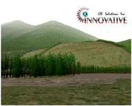
Virtual Forestry
- General-purpose software such as
3D Nature's WCS / VNS, or
ESRI 3D
Analyst is commonly used for forest visualization. However, there
have been a number of forestry-specific applications and projects over the years.
- U.S. Forest Service, Pacific Northwest Research Station
-
 USDA
EnVision -
Environmental Visualization System
USDA
EnVision -
Environmental Visualization System
- non-realtime rendering system for stand- and landscape-scale images
- public domain, Win32 only, currently not very stable
- imports USGS DEMs, geospecific images, and extremely detailed forest
stand information from ESRI Shapefile polygons
- the following parameters are required:
- Stand identifier, Species identifier, Diameter at breast height,
Total tree height, Live crown ratio, Trees per hectare
- can easily draw millions of trees
- USDA Stand Visualization
System (SVS)
- an older software tool for rendering symbolic representations of
a patch of forest
- public domain, Windows only
- Lehrstuhl für Waldwachstumskunde
- "Chair Of Forest Yield Science: System Knowledge for Forests and
Mankind"
- a project at the Technical University of Munich, which models forest
growth, with input from actual measurements of forest plots
- includes software components
TreeView
and l-Vis for 3D visualization
- uses OpenGL, trees are displayed as real 3D objects or billboards depending
on distance
- technical paper, "Three-dimensional
visualization of forest growth" (in German), has link to Win32
demo (2 MB) under "Anhang"
-
 Forester
- a scene composition tool for forestry, $35 for Windows
- outputs POV-Ray format, for rendering with that package
- features listed: Full scene animation, Object/camera flight paths, Motion
Blur, Procedural grass simulation, 3D cloud simulation, Water layer
- elevation import is by means of TerraGen format, so georeferencing is
lost; perhaps this tool belongs on the
Artificial / Artistic page
- includes a tree-modeling companion software, Forester Arboretum, which
is listed on Plant Software
-
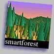 SmartForest
II (1998, historical reference)
SmartForest
II (1998, historical reference)
- a "spatially defensible, object-oriented, visualization system"
from the imaging systems laboratory, dept of landscape architecture, University
of Illinois; later apparently hosted at Imaging Systems
Laboratory,
Dept.
of Landscape Architecture at
Penn State
University
- Historical; most references on the site say 1997; runs on IBM AIX (RS/6000)
platforms, with just an experimental demo version for Windows
-
The Virtual Forest
 (1998, historical reference)
- "Advanced 3-D Visualization Techniques for Forest Management and
Research"
- A set of SGI software developed in cooperation between Pacific Meridian
and Basis in the mid-1990s,
primary developer was Craig Ulbricht.
- A migration to Windows was considered but did not occur. Was used
for several years in support of service contracts to various research and
private sector organizations.
- Closely related to ESRI software, but did not require Arc/Info
- Included a GUI "Tree Impressionist" for designing trees
- Explicit visualization actions including definition of:
- a DTM view
- sun and light source conditions, atmospheric conditions, sky conditions
- vector polygon boundaries
- DTM surface texturing, tree stand boundaries
- planting (tree rendering), and harvesting (tree removal)
- The old article
Visualize Realistic
Landscapes: 3-D Modeling Helps GIS Users Envision Natural Resources (GeoWorld
magazine, 1998) is still cited frequently as the turning point for the full
integration of GIS databases and virtual reality with a particular emphasis
on forestry.
