Standard GIS formats (ESRI Shape, MapInfo...) are commonly used to represent polygonal data. However, there are no standards at all for the per-polygon attributes that go along with these datasets, so importing data (e.g. with VTBuilder) requires a manual step of mapping one set of attributes onto another.
There are some domain-specific polygon data formats, such as USGS LULC, which define a standard for their attributes and can therefore be understood directly by software.
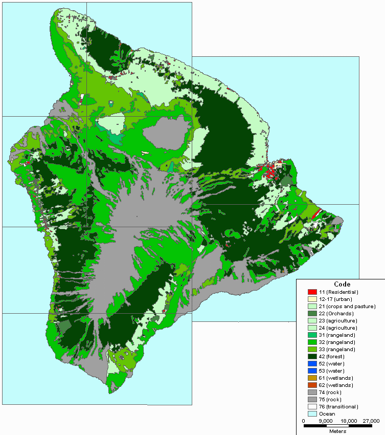
See also: Sources of Data for Distribution of Plants on Terrain